New radar system developed to help marine industry
A NEW radar system to help the marine industry safely navigate is being developed by a pioneering business.
Createc, which has a worldwide reputation for providing imaging, sensors and robotics solutions to a range of sectors including defence, security, rail, aerospace and nuclear industries, has won the contract to develop the new maritime radar system.
Technology and Innovation in UK Maritime Call, a Maritime Research and Innovation UK (MarRI-UK) initiative supported by the Department for Transport, was designed to help the development of technological innovation or proof of concept of new ideas that improves UK Maritime services and operations.
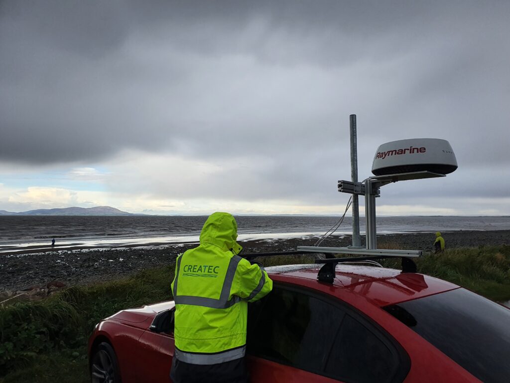
Createc is developing Live Maps: Sea, an infrastructure-free navigation system, designed to assist commercial and naval shipping.
It is being developed as a secure, reliable and independent alternative to current satellite based navigation systems, the Global Positioning System (GPS), satellite-based radio navigation system which is owned by the United States government, being the most common.
The UK government’s Maritime 2050 strategy highlights an over reliance on GPS.
With Brexit on the horizon creating uncertainty on how the UK will access other traditional systems such as the European Galileo global navigation satellite system, the timing of a back-up system such as Live Maps: Sea is also seen as important.
Createc, which has developed a similar system for the aviation industry – Live Maps: Air – tabled its bid to develop an alternative system for the maritime industry in December 2019, was awarded the contract in April this year, and started work on the project last month.
Live Maps: Sea will use hardware systems already present on ships and can easily be retrofitted to existing ships’ systems, without excessive cost, to enhance safety at sea.
Createc has already been working on the algorithm development required and is due to start data collection off the west coast of Scotland next month.
The aim of the first at-sea trial is to provide proof of concept that the Live Maps: Sea system – which integrates live radar data with coastline reference mapping – works within operating range of the radar.
Createc robotics engineer Sam Jakobson said: “GPS can be subjected to disruption and spoofing, such as areas of the world where pirates are active.
“Also if GPS fails then you have to revert to a very old fashioned system of reading from charts.
“There’s a big gap in the market for an alternative which would be an important navigation aid for all naval and commercial shipping.
“Our alternative provides a standalone, infrastructure-free system, needing no land-based transmitters. This means it has worldwide capability, not being tied to any network of land-based units.”
The Live Maps: Sea system will also aid the introduction of autonomy to the naval sector. Increasing fail-safes and improving resilience will assist commercial shipping which make repetitive journeys on predetermined routes.
Createc, which celebrated its 10th anniversary in June 2020, is defined by a speciality rather than a market, focussing on developing solutions for customers using imaging, sensing and robotics.
Createc provides commercially-viable solutions to a range of industries, including the civil nuclear, oil and gas, construction, engineering, medical, aerospace, rail, marine, defence and security sectors.