Inside Walkingworld – the popular online walking guide with over 6500 routes
Walkingworld, the popular online walking guide with over 6500 walks in England, Scotland and Wales, has released an app giving access to its entire library. The app, available for Android™ and iOS™ phones and tablets, can be installed for free. Walks are downloaded to the device for offline use.
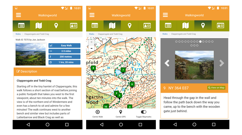
The Walkingworld library has been built up over 17 years but this is the first time the routes have been made available through a dedicated app. The app has been created in partnership with national mapping agency Ordnance Survey, which provides digital mapping through their ‘OS Maps’ service.
Walkingworld guides are designed to be very easy to follow. They are built around a set of geo-located waymarks, each of which marks a major decision point on the walk. Waymarks consist of a photograph – so walkers can readily identify that they are in the right place – and clear instructions to the next waymark on the walk. The app allows the walker to switch easily between the waymarks and their location on a map, where their current GPS position is also displayed.
For free users of the app the walk is shown on a simplified map. If users upgrade for £18 a year the walks can be viewed on OS 1:50,000 Landranger and 1:25,000 Explorer maps, long regarded as the ‘gold standard’ for walkers. The annual subscription also allows the printing out of the walk guide and OS map, the download of a digital mapping file for other GPS devices and the storage of more than one walk at a time on the mobile device.